To the west of the Black Canyon of the Gunnison and near Grand Junction is the largest of the mesas of the Colorado Plateau and in fact in the world. The 11,000+ foot high Grand Mesa is a landscape of sedimentary rock that was preserved from erosion by a volcanic cap of basalt. It sits between the Colorado River and the Gunnison River. This 11,000 foot flat-topped plateau stand thousands of feet above the surrounding landscape. It is more than 6000 feet higher than nearby Grand Junction.
Driving up the talus covered Grand Mesa with the basalt cap clearly visible above.
We decided to hike that volcanic summit ridge and get an unparalleled panoramic view of the region from the top. From the Grand Mesa, the multi-colored hues of the sedimentary rocks of the Colorado Plateau are clearly visible, including the Colorado National Monument west of Grand Junction.
The volcanic ridgeline above the mesa is called Crags Crest
Colorado National Monument across the Grand Valley from Crags Crest
Of course, when you are up at 11,000 feet in Colorado, you are approaching treeline and there are some very beautiful mountain meadows full of wildflowers mixed in and amongst the spruce and aspen forests.
Linda and Maile arriving at the summit
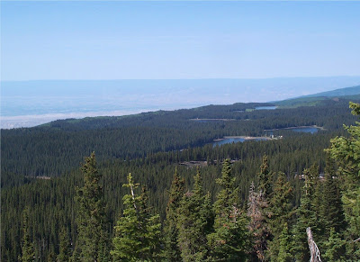
Some 300 mountain lakes dot the Grand Mesa
It was certainly a very chilly night camping at 11,000 feet, so we did not stay the extra day we'd planned to do another hike up there. Rather, we toured a little bit up there and then headed down to Grand Junction to get a hotel room, a shower, pizza, and a movie.


No comments:
Post a Comment